State parks along the route include Lake Bronson on the western end, Hayes
Lake, Zippel Bay and Franz Jevne.
As the routes name suggests,
this far northern byway offers nighttime visitors an excellent chance of
seeing the magnificent Aurora Borealis, better known as Northern Lights.
Note: The NWRDC created the
Land of the Dancing Sky logo to complement this effort.
King of Trails
Scenic Byway
Stretching from the Gulf of
Mexico and north to Canada, Highway
75 was dubbed the King of Trails 90 years ago. The Minnesota
portion, King of Trails Scenic Byway, stretches 414 miles along the
western border.
One of the attractions of this
byway is the lack of tourist spots. The byway travels through small farming
communities, expansive grain fields, wide grasslands, and picturesque state
parks.
This group has a
wonderful web site at www.mnbirdtrail.com that you must check out. It
contains birding information, maps, and contact information.
The trail goes from
Warroad to Greenbush on Hwy 11 then south on Hwy 59 to
Fergus Falls, Minnesota.
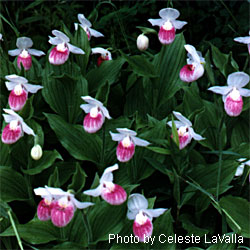
Minnesota
Wildflower Route
From Greenbush to Baudette across
the north part of Minnesota along Highway 11. This route is a smaller
section of the Waters of the Dancing Sky Scenic Byway.
This route features Minnesota's
protected state flower the Lady Slipper.
It complements other efforts
including the National Prairie Passage Route listed below.
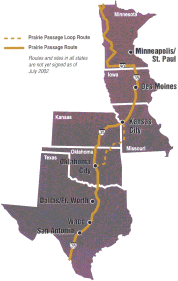
Minnesota,
in partnership with five other states, has developed a corridor of roads
called "Prairie Passage" to protect and restore remnants of prairie, and to
draw today's travelers to explore this natural heritage at prairie sites
along the route.
In Minnesota,
the 600-mile Prairie Passage route meanders down the western side of the state,
from Hallock to Luverne, and along I-90 in the far south between Luverne and
Albert Lea.
The Red
Lake River Corridor web site has information about trip planning,
activities, maps and much more.
The Red Lake River is one of a
few state canoe routes in Northwest Minnesota. It flows west from
the Upper/Lower Red Lake to the Red River in East Grand Forks.
For centuries Native peoples
and the "Coureur des Bois" paddled the historic boundary waters of this
east-west route joining Lake Superior to the western prairies. Today you
can explore the beauty and wonder of the original route on good roads
linking southeastern Manitoba,
northern Minnesota, and
northwestern Ontario with Lake
Superior.
Consists of over 400 miles of paved roads
(Highways 11 and 12) in two countries.
Includes the city of Warroad in
Northwest Minnesota as well as Baudette, Winnipeg, Thunder Bay, Rainy
River, Steinbach, Sprague, Fort Frances and Atikokan.
 Waters
of the Dancing Sky Scenic Byway
Waters
of the Dancing Sky Scenic Byway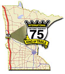
 Minnesota
Wildflower Route
Minnesota
Wildflower Route